Subscribe for all my updates and don't miss a thing! Sign me up!
An Interactive
Map Of Montego Bay Jamaica
Sharing Is Caring! Share this awesome content with your friends now.

Thanks to Google's amazing and powerful technology, you can now view the city of Montego Bay right from your computer.
I'll show you that one and two more static maps that you might find very handy.
New! Take a piece of Jamaica with you💃!
Savour the memories! Now you can get your authentic Jamaican souvenir items, as well as traditional Jamaican herbs, spices and housewares on our popular e-store. Click Here to learn more.
And, if you ever need a trustworthy and knowledgeable local guide, consider booking a private tour with us!
Like most developing cities, the landscape in Montego Bay does change pretty rapidly, but despite that, Montego Bay's road network remains - for the most part, what it has been for the last few decades.
The main streets, namely Gloucester Avenue (The Hip Strip), Queen's Drive, Sunset Boulevard, Saint James Street, Barnett Street, Howard Cooke Boulevard nd Fairfield Road all remains - even after the construction of the highway.
So how can you navigate or interact with the map?
It's easy...
Simply click on the image below [Opens in a new window], you'll be taken directly to Google Maps where you will be able to do many things, including zooming in and out and making a note of significant points of interest.
In addition to the regular 'map' view, Google also provides a satellite view and a what they call a hybrid view.
Look for the button on the top of the view and try them out, particularly the hybrid, it's really neat!

Watch Video! Montego Bay City Tour!

There are two other Montego bay maps that I think you'll find useful though, one is from the I think you'll find the Jamaican Caves Association's map of Montego Bay quite useful.
Not only does this one highlight the major road networks, it also shows major landmarks in addition to districts (communities) in the vicinity. It even shows the locations of schools and churches! Here is the Cave Association Map.
Make sure you check out the Google version though, by clicking on the image above.
You might like these
Montego Bay Jamaica Hotels - A Quick Guide To the Best Ones
Montego Bay Jamaica Hotels - A quick guide to the best accomodation in the friendly city.
What Is In Rose Hall Jamaica? History, Fun & Adventure In Montego Bay
What is in Rose Hall Jamaica? Well, Rose Hall is filled with resorts, attractions and restaurants all the ingredients for an exciting vacation.
Best Montego Bay Airport Transfers? Here Is My Recommendation
Top Montego Bay airport transfers operators - Here are the top ones, with prices and contact information.


Sharing IS Caring! Please help me get the message out by sharing this article with your friends on social media (links below). Thnx ;-)
If you found this page useful, please consider subscribing to my weekly newsletter, to get even more.
It tells you each week about the new information that I have added, including new developments and great stories from lovers of Jamaica!
Return to Map of Jamaica from Map of Montego Bay Jamaica
Return to My Island Jamaica Homepage from Map of Montego Bay Jamaica
References & Sources For Map of Montego Bay Jamaica
- Related Jamaica News Media Top Sources For Jamaican News, https://www.my-island-jamaica.com/jamaica_news_media.html
- Google Maps Montego Bay, https://www.google.com/search?q=google+maps+montego+bay&oq=google+maps&aqs=chrome.3.69i57j0i67i131i433j0i67j0i20i263i512j0i512l3j69i60.5596j0j7&sourceid=chrome&ie=UTF-8
- Jamaican Caves Organization, http://www.jamaicancaves.org/map_montego_bay.htm
New! Get My Latest Book👇🏿
 |
You asked, I've answered! You no longer need to save for months or years, to enjoy paradise! I spilled the beans! sharing my top tips on finding cozy accommodations and secret gems, only the way a native could! Click Here to pick it up on my e-store and start saving now! |
See The Best Of Jamaica - In Videos!
 |
My channel reaches over 140,000 subscribers worldwide and has leveraged over 11 million views, sharing, what I call 'The Real Jamaica'. Subscribe today and join our family of viewers. |

Read More ...
New! Experience The REAL Jamaica!
Book Your Private Tour here and experience Jamaica the way we (locals) do!
P.S. Didn't find what you were looking for?
Still need help?
Click Here to try our dependable and effective Site Search tool. It works!
Or, simply click here and here, to browse my library of over 500 questions and answers! Chances are someone already asked (and got an answer to) your question.
Featured Video!

Travelling To Jamaica?
Read this BEFORE you go
👇🏿

New Here?
I recommend you START HERE to enjoy the best of this website!
New! For Authentic Jamaican products, from my very own hands, visit my Etsy store here.
Recent Articles
-
Semi-Contract (Epazote) in Jamaica: Uses, Benefits and Safety
Mar 27, 26 02:58 PM
 Discover how Semi-Contract (Epazote) is used in Jamaica, what it’s traditionally known for, how to use it safely, and which form makes the most sense to buy.
 -
Tamarind in Jamaica: Leaves, Pods, Seeds and Health Benefits
Mar 26, 26 12:00 AM
 Explore tamarind in Jamaica—leaf tea, fruit pulp, seeds, traditional uses, and practical wellness benefits, plus the best forms to use.
 -
Why do Jamaicans eat bun and cheese for Easter? | Jamaican Easter Traditions
Mar 19, 26 12:45 PM
By Kesha Stewart | Associate Writer See Also: What do Jamaicans do for Easter? Most Jamaicans consider certain things mandatory for the perfect Easter -
Culantro (Spirit Weed): Jamaica’s Powerful Healing Herb
Feb 15, 26 03:18 PM
Discover culantro (Spirit Weed) health benefits, traditional Jamaican uses, tea preparation, and research on Eryngium foetidum. -
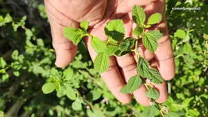
Jamaican Colic Mint - The Backyard Herb Trusted For Generations
Jan 16, 26 04:52 PM
 If you grew up in Jamaica, chances are you’ve seen Colic Mint growing quietly somewhere nearby, along a fence or at the edge of a yard.


About The Author

A patriotic Jamaican who adores its culture, Wellesley has been using this medium to share what he calls 'the uniqueness of Jamaica with the world' since April 2007.
To date, he serves over 9,300 unique readers / viewers per day (and over 1.1millon page views monthly)
His efforts have earned this site featured positions in local publications, including the Jamaica Gleaner's Hospitality Jamaica, Carlong Publishers, as well as recognition from numerous prestigious international agencies and universities. Read more about him here.
He invites you to explore his books and subscribe to this site to stay updated on all the latest here on site.
You are also welcome to check out his unique Jamaican products on his e-store.
If you are on social media, here are the links to follow his latest posts:
You are also invited to join his exclusive JAMHearts community where like-minded Jamaican enthusiasts discuss all things Jamaican.
Didn't Find What You Are Seeking?
Do a quick site search here:
New! Comments
Have your say about what you just read! Leave me a comment in the box below.